“Begin challenging your own assumptions. Your assumptions are your windows on the world. Scrub them off every once in a while, or the light won’t come in.” - Alan Alda

Sleeping Bear Heritage Trail’s goal and guiding principles
According to the NPS 2009 Leelanau Scenic Heritage Route Trailway Plan and Environmental Assessment, the goal of the Sleeping Bear Heritage Trail is to: “Create a non-motorized linear trailway system that is connected to historical, cultural, recreational, and environmental points of interest throughout the Lakeshore and surrounding communities; a Trailway that promotes health, environmental, social, and economic benefits and provides a safe alternative for walking, biking, running, and cross-country skiing; and is universally accessible wherever possible.”
The 2009 NPS Trailway Plan laid out Guiding Principles to steer the planning process::
Promote and encourage people to engage in healthy lifestyles benefiting from non-motorized trails.
Strengthen trail connections to existing trailheads, communities, and points of interest within the project boundary.
Enhance the recreational experience within the Sleeping Bear Dunes National Lakeshore (Lakeshore) and project area.
Incorporate universal design principles with regard to trail alignment, cross-sectional design, and trailhead development.
Consider the impacts that could occur to the environment and existing ecosystems.
Consider the impacts that could occur to historic properties and archeological resources.
Design a trail cross-section and trail alignment that is sustainable with regard to materials.
Provide a safe non-motorized trail facility.

Proposed Segment 9 Heritage Trail
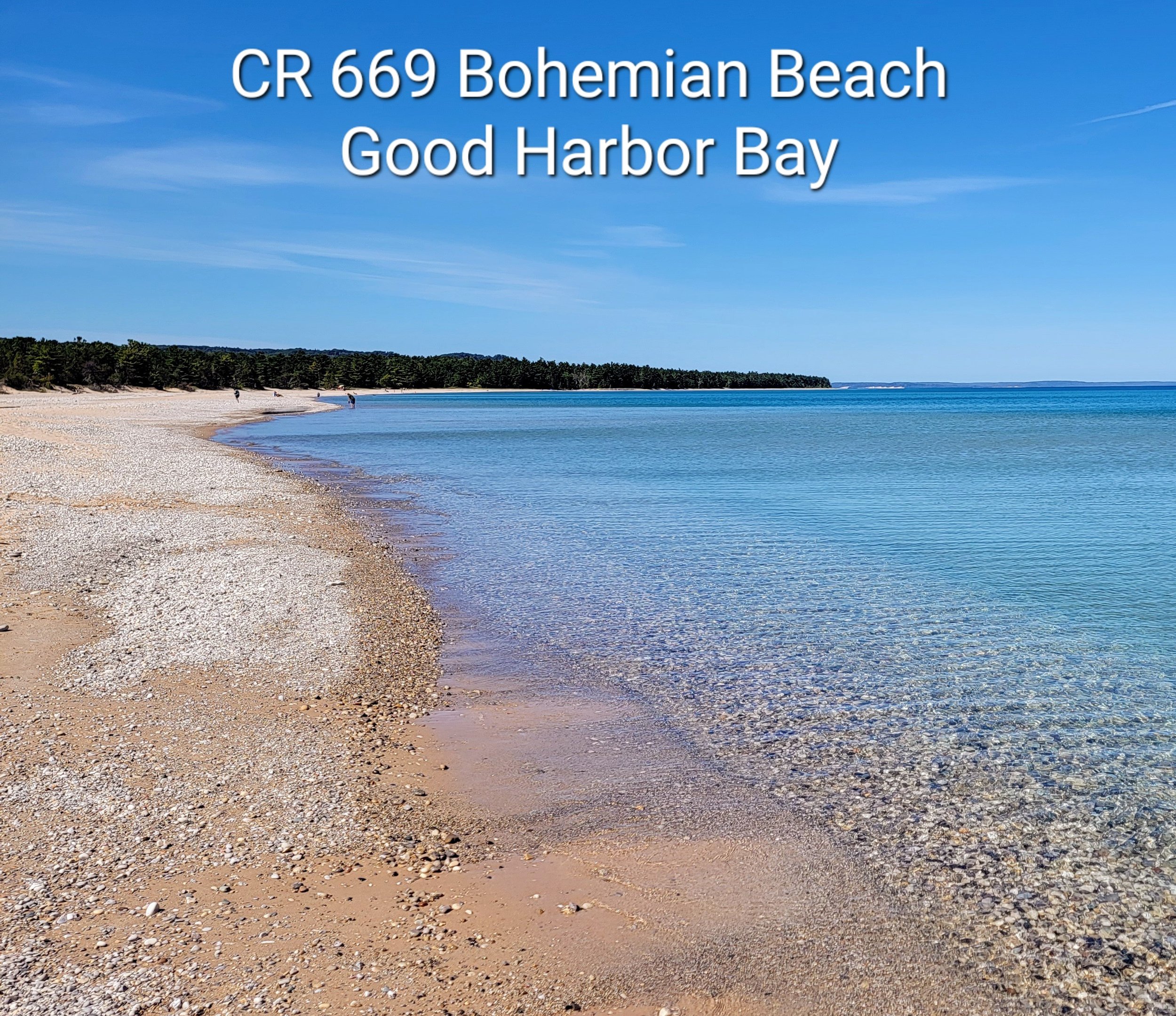
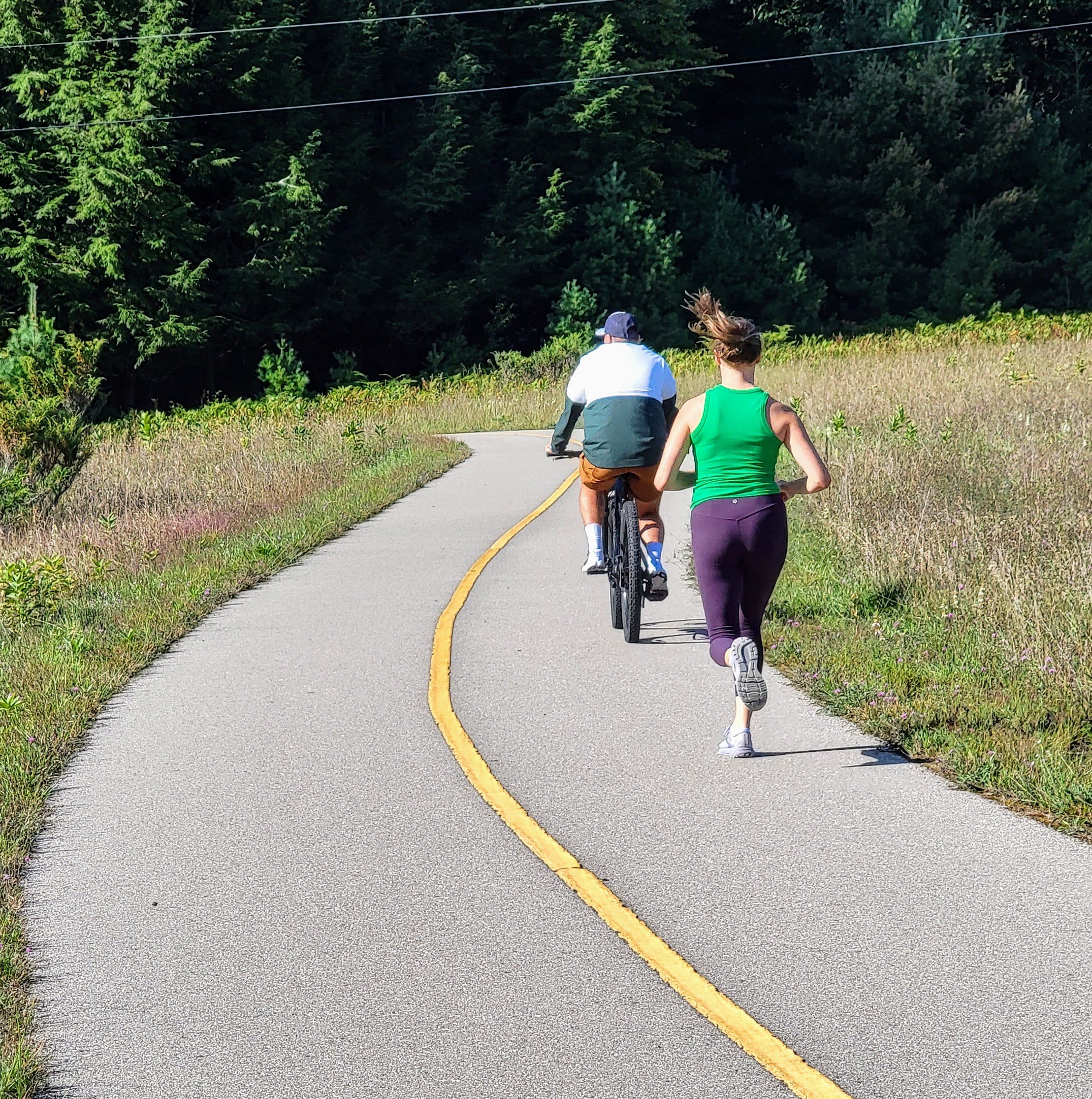
The Sleeping Bear Heritage Trail currently consists of 22 miles of mostly off-road trail , with several portions using shared road access, extending through the Sleeping Bear National Lakeshore in Leelanau County, Michigan. This current trail is mostly a paved 10’ wide asphalt with the section through Port Oneida Historical District being a crushed limestone path. The trail runs from Empire, through Glen Arbor, past Port Oneida Historical District and currently ends at the intersection of M-22 and Bohemian Rd / CR 669 near the Cleveland Township Hall.
Segment 9 is proposed to extend the Heritage Trail another 4.25 miles along Traverse Lake Road to the intersection of M-22 and Good Harbor Trail / CR 651. This segment is currently in the design and engineering phase. After engineering completion, permit approvals are required prior to anticipated construction in 2025, provided the necessary funds are in place to cover the construction bids received. The project oversight is being provided by the National Park Service with TART Trails providing leadership and assuming responsibility for the fundraising and Michigan Department of Transportation overseeing trail design.


Become familiar with route
There is more to understanding than looking at a line on a map. Segment 9 route has been staked and flagged since May 2023. Go walk the staked route yourself to fully understand. Experience the ecosystems!
Segment 9 starts at the intersection of M-22 and Bohemian / CR 669, then heads east along M-22, turns north within the wetlands along Traverse Lake Road, follows east along Traverse Lake Road within a mature dune forest, cuts through steep State-protected Critical Dunes, then turns north towards the Bufka farm through a vulnerable wooded dune and swale complex and continues past the Bufka farm through another wooded dune and swale complex until it reaches the intersection of M-22 Good Harbor Trail / CR 651. There is no plan yet to reach the beach at the end of the county road. The Good Harbor Trail beach is popular during summer and there is not ample parking with cars parking up the side of the access road.
A Segment 9 summary diagram was completed by Mansfield Land Use Consultants as part of their Dune Cut Analysis. A thorough document “Heritage Trail Aspects: Preliminary Heritage Trail Staking for Segment 9” describing the trail route and likely construction designs was compiled by Little Traverse Lake Association August 2023 and can also be found here.
Priorities, assumptions and application
It’s important to understand some basic end goals when designing a trail project.
FOUNDING PURPOSE The founding mission of the National Park Service is to protect natural features and ecosystems of the area and to prevent them from being fragmented or developed. According to the enabling legislation that created the Sleeping Bear Dunes National Lakeshore: “the Congress finds that certain outstanding natural features, including forests, beaches, dune formations, and ancient glacial phenomena, exist along the mainland shore of Lake Michigan and on certain nearby islands in Benzie and Leelanau" Counties, Michigan, and that such features ought to be preserved in their natural setting and protected from developments and uses which would destroy the scenic beauty and natural character of the area. …the Secretary (of the Interior) shall administer and protect Sleeping Bear Dunes National Lakeshore in a manner which provides for recreational opportunities consistent with the maximum protection of the natural environment within the area.” (PUBLIC LAW 91-479-OCT. 21, 1970)
MAIN PRIORITY This mission to protect natural ecosystems supersedes the goal of building bike paths. This should be the starting foundation in the planning process, not a lesser priority to building paved trails. Sometimes unique and protected ecosystems, like the federal Wilderness Area, should be the first, not the last, consideration in the planning process.
The trail planning process did not start by FIRST understanding the ecosystems and environmental features but by drawing lines on a map for a trail network. NPS or TART Trails did not do a botanical survey as part of the planning process, and still have not completed one.. The driving focus behind the Segment 9 extension appears to be building paved trails, which is certainly the primary mission of TART Trails. TART Trails has publicly stated the end goal is to connect to Suttons Bay. Segment 9 did not first begin by asking what is best for this Good Harbor Bay region based on non-intrusive ecosystem management while still creating desirable user experiences that benefit visitors driving to the Lakeshore to bike or walk. And it did not follow the Lakeshore’s General Management Plan which establishes priority locations for recreational use and for protection of the natural environment.
TAILOR RECREATIONAL OPPORTUNITIES One of the stated goals of the Sleeping Bear Heritage Trail is to provide ways for visitors to explore the park outside of just using a vehicle. This can be accomplished in many different ways. It can be bike routes, multiuse trails, walking paths, hiking paths and use of watercraft. A 10’ paved asphalt path is not the only way to meet this objective. Sometimes different methods of non-vehicular travel are better suited to truly enjoy the natural experience of sensitive ecosystems The type of trail should be considered for suitability and adaptability to ecosystems, whether an asphalt, gravel or natural forest duff path, whether a bike path, walking path or multiuse.
GOOD HARBOR EXPERIENCE A purpose of Segment 9 is to introduce visitors to the features in the Good Harbor Region, with Good Harbor Bay being the main attraction as a destination. Good Harbor Bay can be equally accessed via Bohemian Road / CR 669 or Good Harbor Trail / CR 651. Nowhere along the Heritage Trail do visitors experience the sights and sounds of Lake Michigan. Lake Michigan Road has several features along the way that are of value for the visitor to experience. There are many natural features in the Segment 9 region besides the Bufka Farm (visitors are exposed to old farmsteads in the Port Oneida Historical District), including Lake Michigan shoreline, Shell Lake, and the Good Harbor Bay Trail and Picnic Area.
Justifiable user demand?
Off-road trails began as a movement to repurpose old railbeds to bike trails. Once that conversion was maximized, the focus shifted to building separate off-road trails. Not all trail ideas should or need to be built. Here are ten questions that are important to ask in planning and prioritizing trail construction: 1) What options currently exist? 2) Is there a transportation need as part of daily commuting? 3) Will it help get us our goods and services or aid in daily living? 4) Is it near population centers and will it connect population centers? 5) What is the user demand? 6) Will trail construction enhance the landscape character of the local community? 7) Will there be minimal impact to the environment? 8) Are design and construction requirements minimal? 9) Are costs reasonable? 10)Are there alternative ways to accomplish the goals and objectives?
Those questions are pertinent to Segment 9 trail planning as well.
There are presently 22 miles of recreational opportunities for visitors to the Lakeshore. Users do not ride from one end to another (44 miles roundtrip). Most trips are shorter excursions. If someone is looking for an off-road experience, the existing 22 miles provides lots of options. The demand for another 4.25 miles, in addition to the 22 miles, is questionable based on user patterns toward the Good Harbor area and is worthy of discussion.
The usage of the Heritage Trial is highest between Glen Arbor and Empire. The volume of users drops off considerably the farther east from Glen Arbor. Based on 2016 data, the Port Oneida – CR 669 area has an average of less than 100 persons per day or an average of 8 per hour with a maximum of 12 users per hour. In comparison, the busiest section, Glen Haven, had 475 persons per day or an average of 40 per hour with a maximum of 75 users per hour. The users in the Port Oneida area could benefit from access to Good Harbor Bay and a trailhead, but that can be accomplished in other ways than just the proposed Segment 9.
There is not a significant population base living in the Good Harbor Bay region. Cleveland Township has a population of approximately 1,200 people; Centerville Township has about 1,600 people. Most of the trail users will be summer visitors driving to this area to utilize various recreational opportunities for only a few months. The Heritage Trail east of the Homestead is not a major connector trail that will substitute for people bicycling rather than driving as part of everyday commuting. This Good Harbor region is predominantly a “drive to bike” trail for most people, who currently have 22 miles of biking and trail opportunities.

A primary driver at the beginning of the Sleeping Bear Heritage Trail concept was to create additional economic benefit to the area for local businesses with the Heritage Trail being an attraction for visitors coming to Sleeping Bear Dunes National Lakeshore. Park visitation has increased and businesses have experienced more economic reward since the first segment of the Heritage Trail was constructed in 2012 - partly due to the appeal of the existing 22 mile Heritage Trail as well as the designation of America’s Most Beautiful Place. However, building an additional 4.25 miles at the northern end will not lead to a substantial increase in business activity as a direct result of adding this trail segment.
Other alternatives exist that are cheaper, have less environmental impact, and still provide quality recreational opportunities. It is questionable what demand exists that justifies Segment 9. While some local community residents are in support, many are not. Trail opportunities are wonderful but actual usage numbers for the area east of Port Oneida should be taken into account to get a realistic estimate of demand.
Segment 9 efforts paused by NPS
In November 2024, Scott Tucker, Superintendent of Sleeping Bear Dunes National Lakeshore, announced that NPS is pausing efforts on the proposed Segment 9 extension of the Heritage Trail following ongoing consultations with the Grand Traverse Band of Ottawa and Chippewa Indians. 2024 was a year of much engagement, community discussion, and release of environmental and engineering analysis. For a summary of 2024 happenings related to the Heritage Trail Segment 9, click here.
During March 2026 SBN-NPS email correspondence, Superintendent Scott Tucker provided greater clarification of the Segment 9 Heritage Trail status:
“At this time, all planning for Segment 9 of the Sleeping Bear Heritage Trail has been completed and closed out. There are no actions planned at this time, nor are any future actions anticipated. If any future planning efforts are initiated for the National Lakeshore, we will begin with public scoping followed by an Environmental Assessment.”
NPS Press Conference Nov 2024